OsmAnd Configuration
Opening Map Screen
Press the menu hamburger in the lower left corner of the screen to select the main menu to get started.
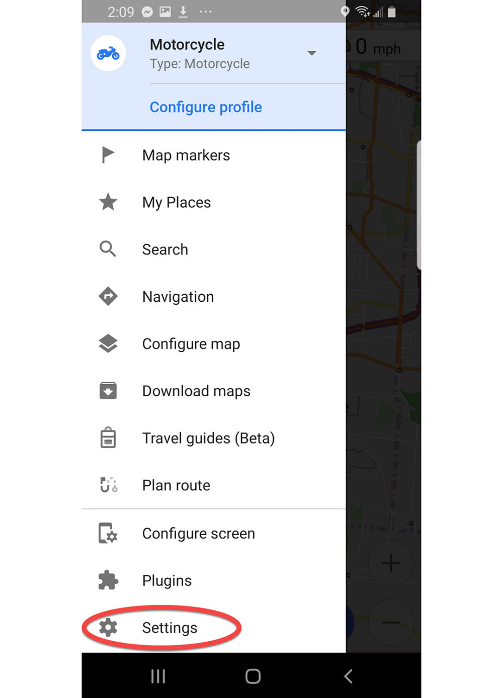
Main Menu
Main menu has many options. Start by pressing Settings.
Settings Page
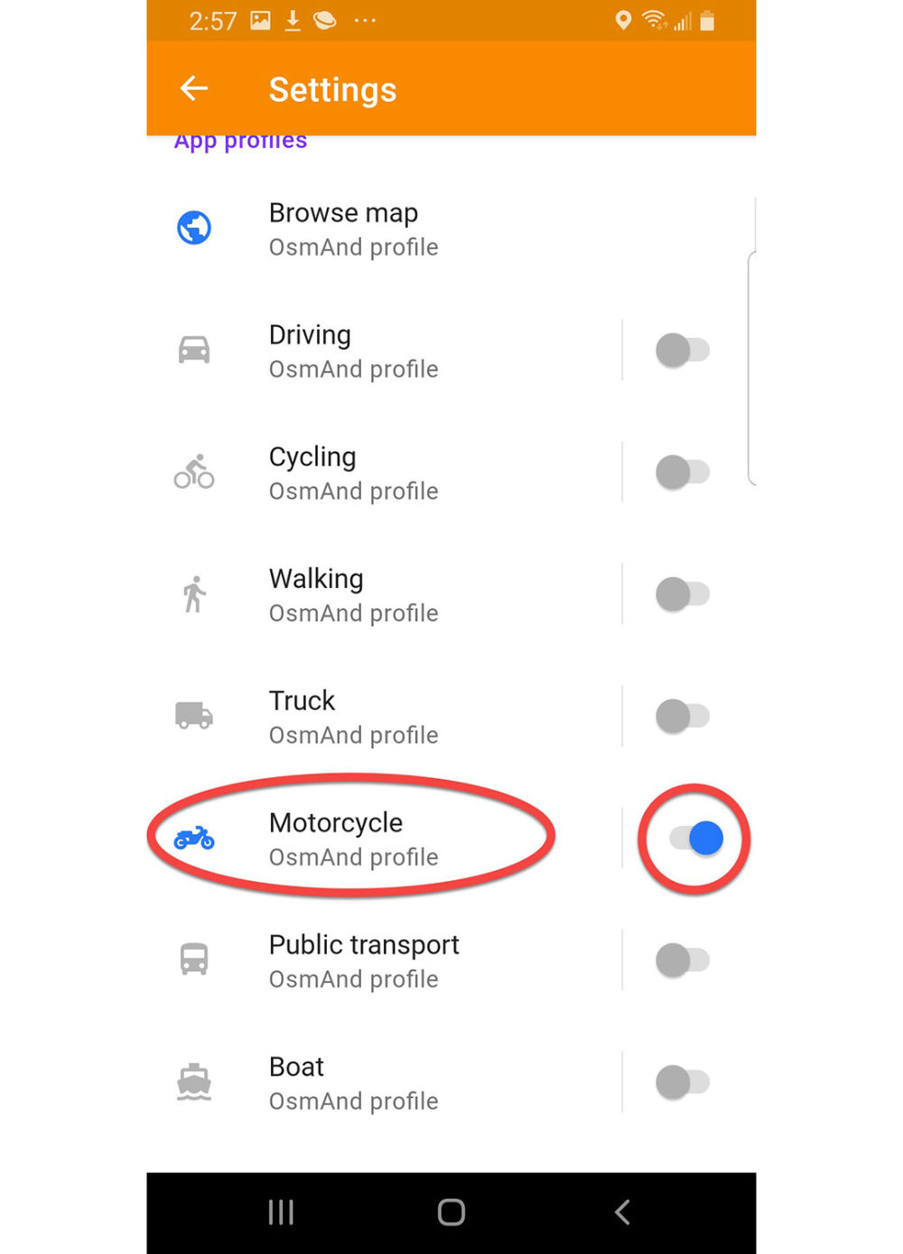
Go directly to App Profiles and scroll down.
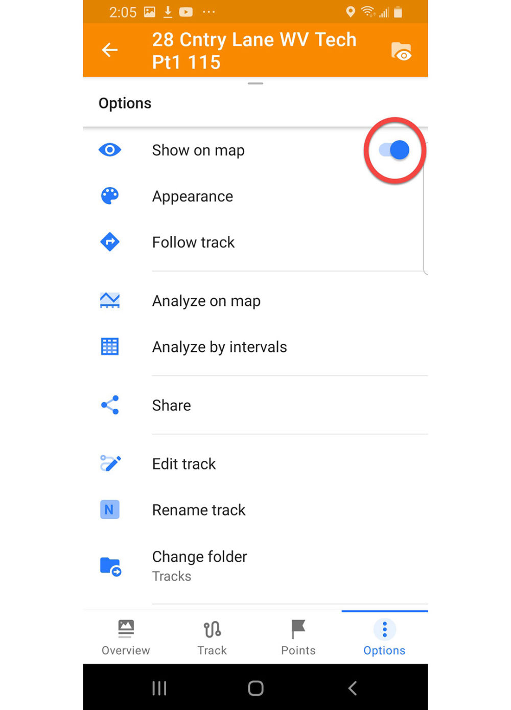
Motorcycle App Profile
Enable the Motorcycle profile and press it to adjust settings.
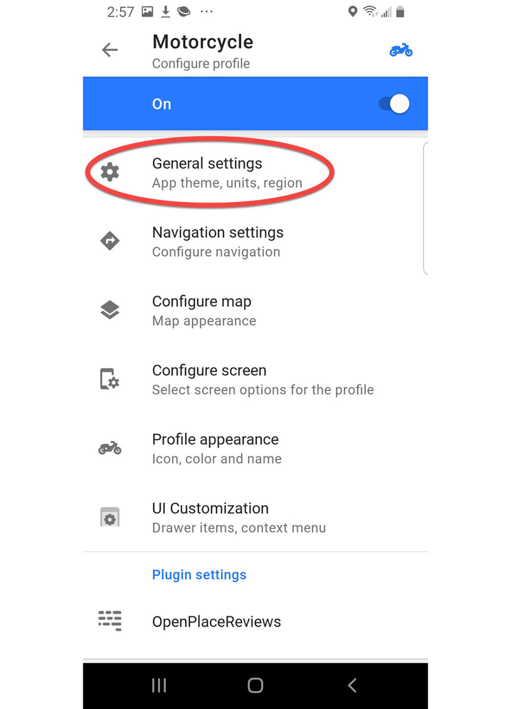
Motorcycle Configure Profile
Press General Settings
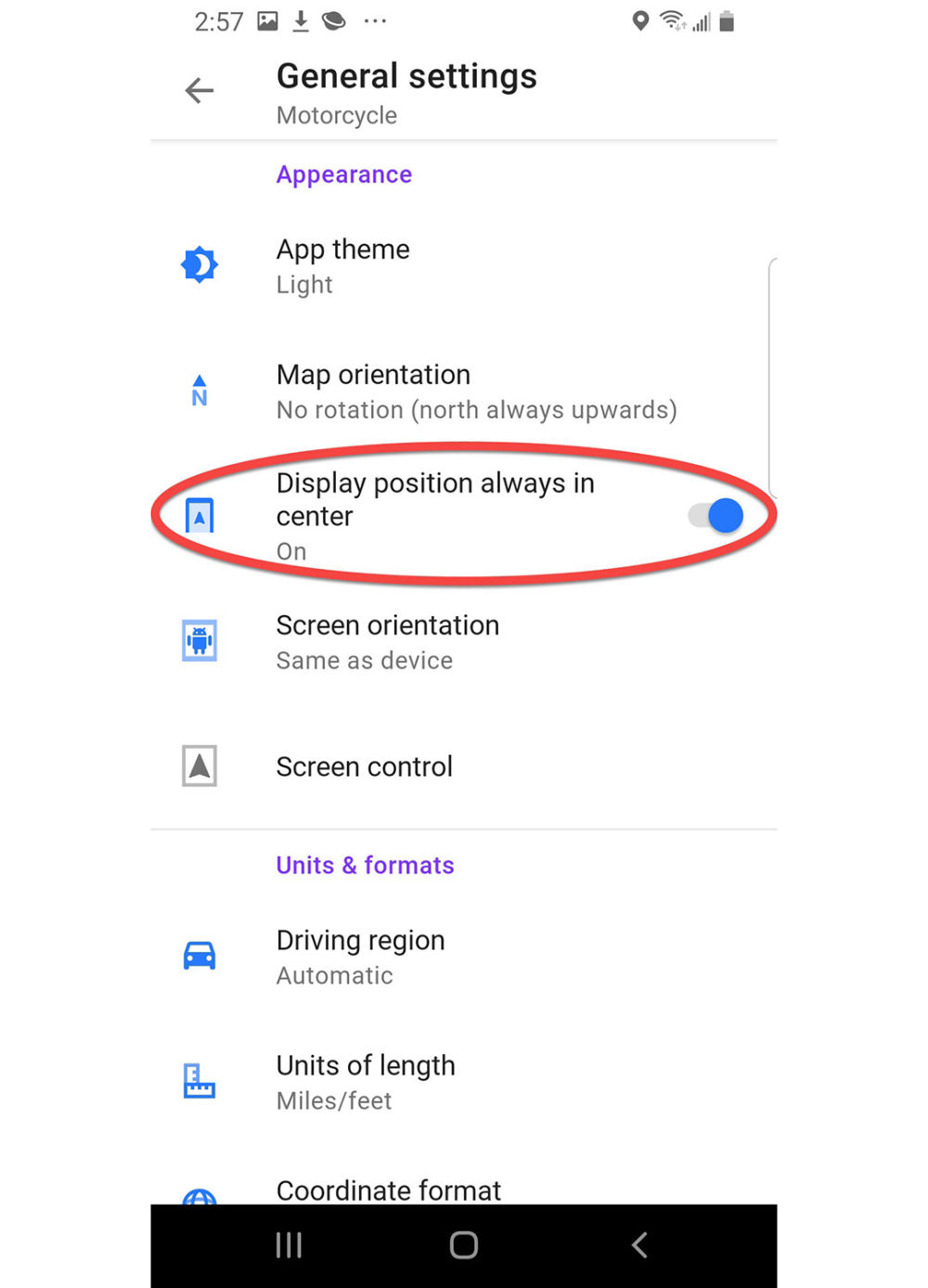
General Settings Motorcycle
Enable Display position always in center
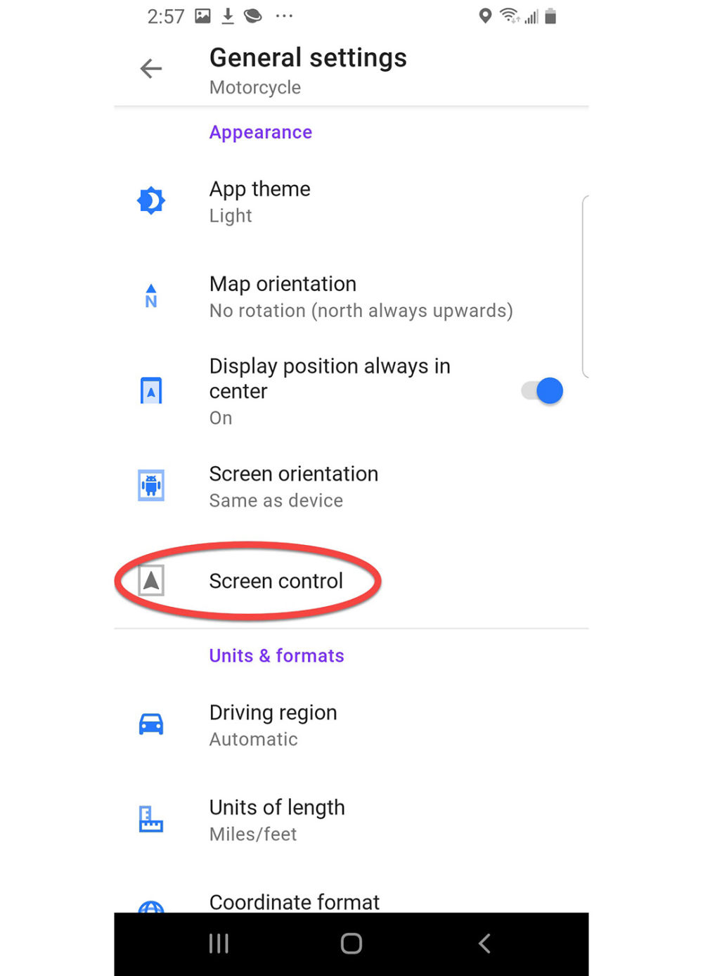
General Settings Motorcycle
Press Screen control
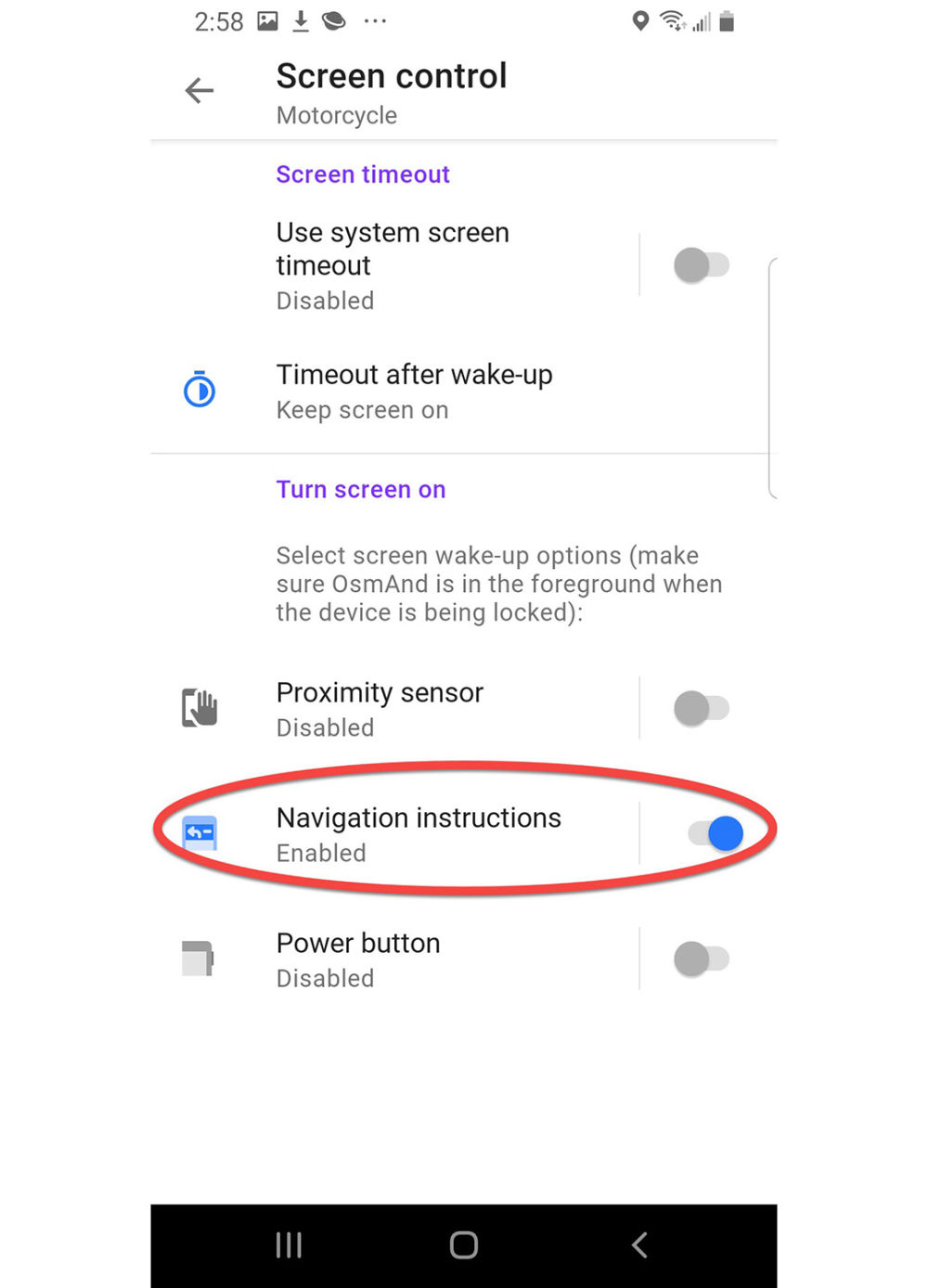
Screen Control Motorcycle
Enable Navigation instructions, press the Back arrow (left arrow located near upper left of screen) two times to return to Motorcycle Configure profile
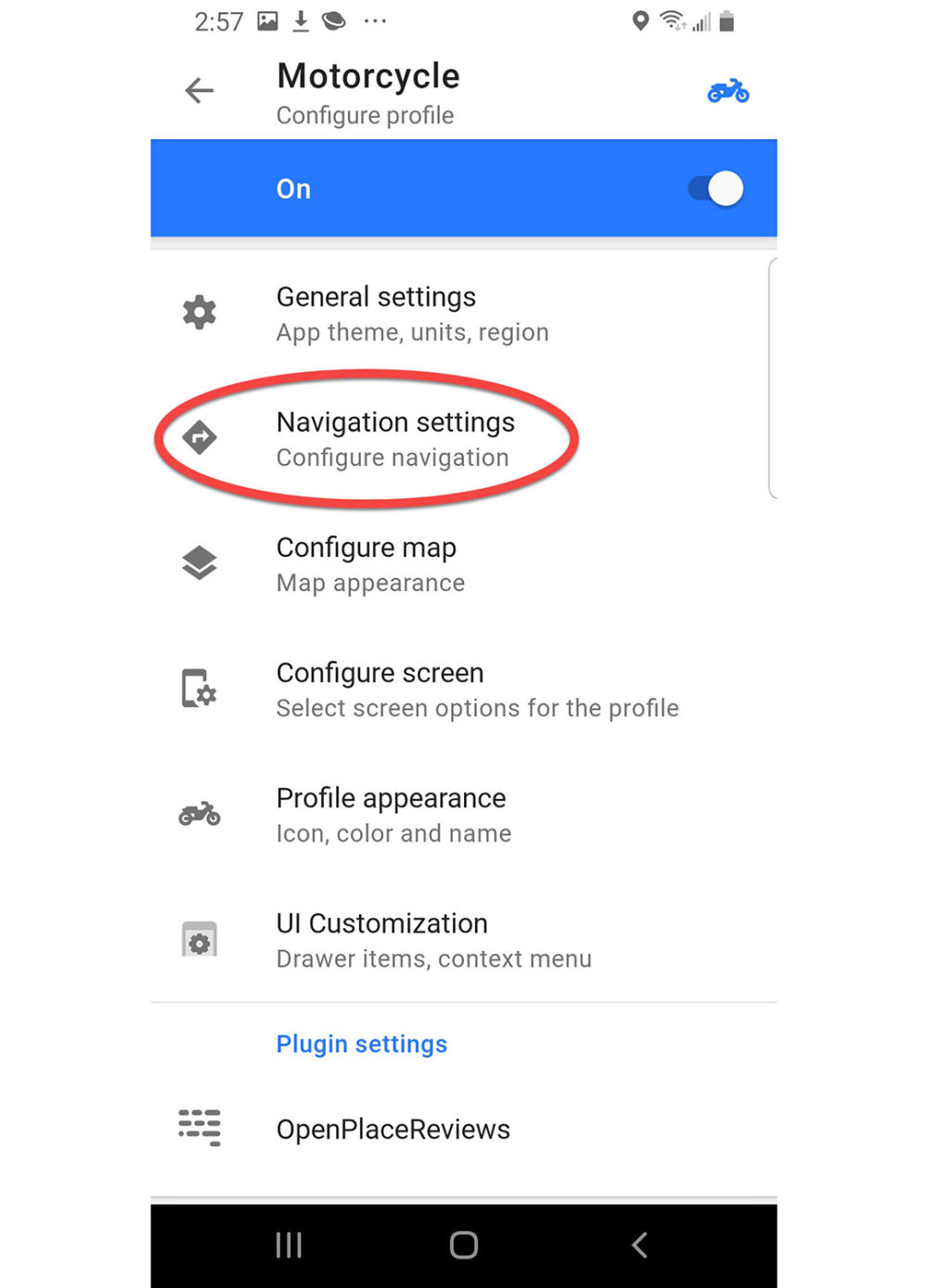
Motorcycle Configure profile
Press Navigation Settings
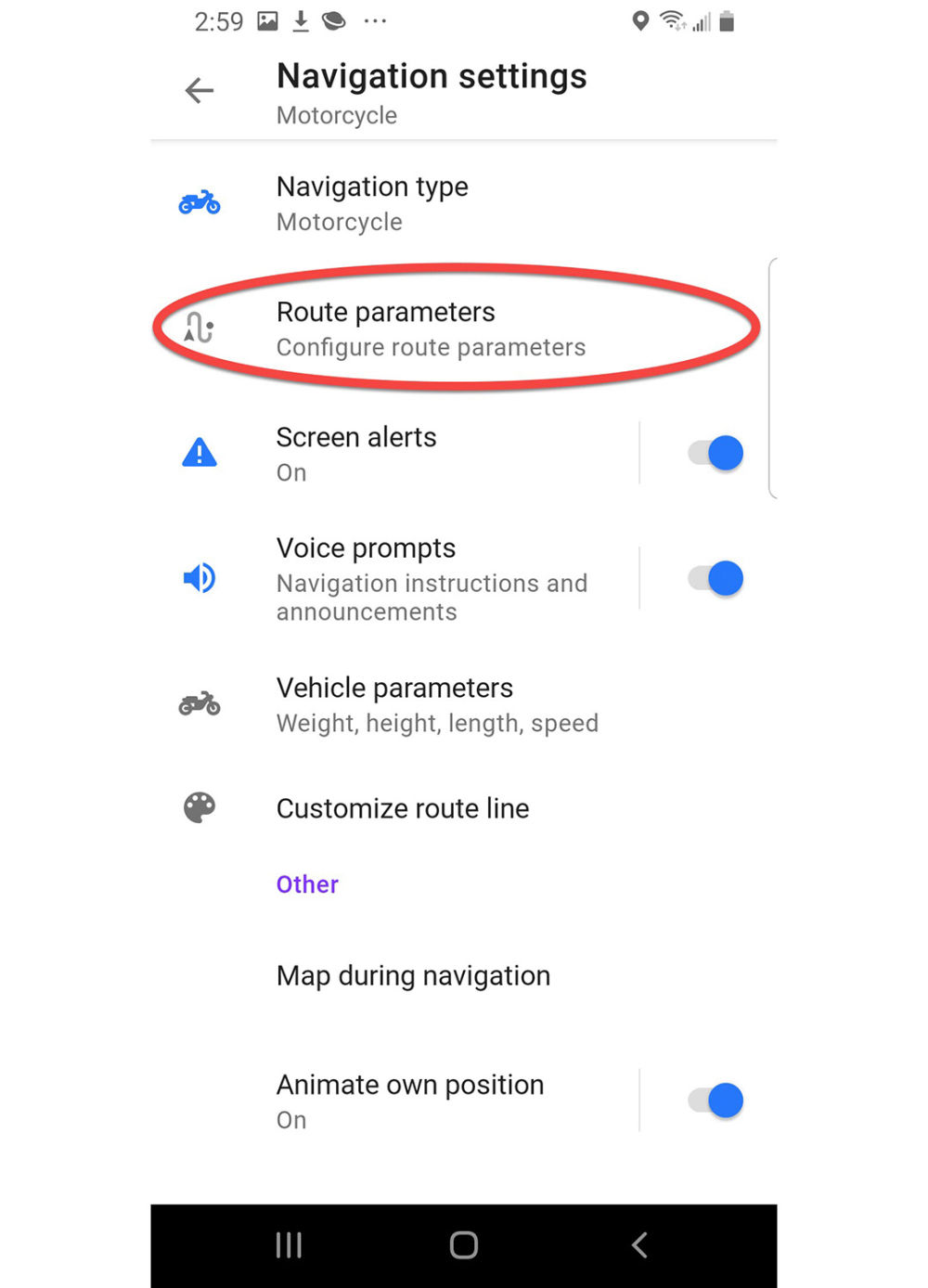
Navigation settings Motorcycle
Press Route Parameters
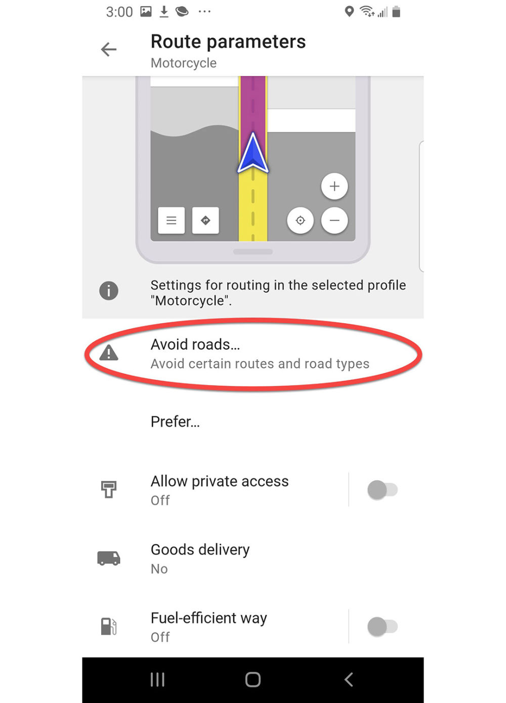
Route parameters settings Motorcycle
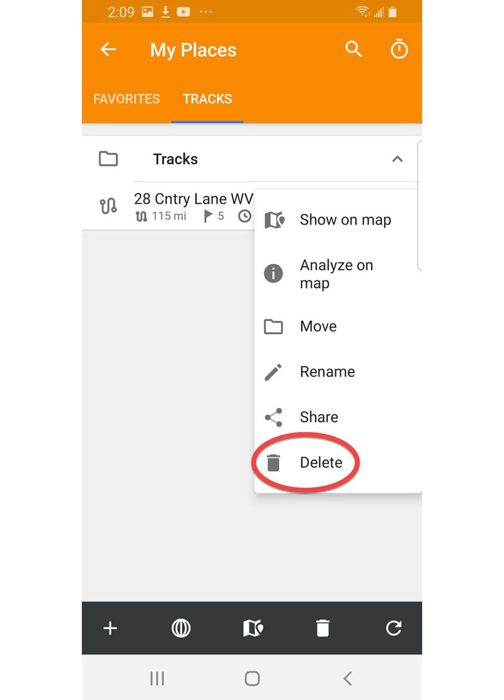
Press Avoid roads...
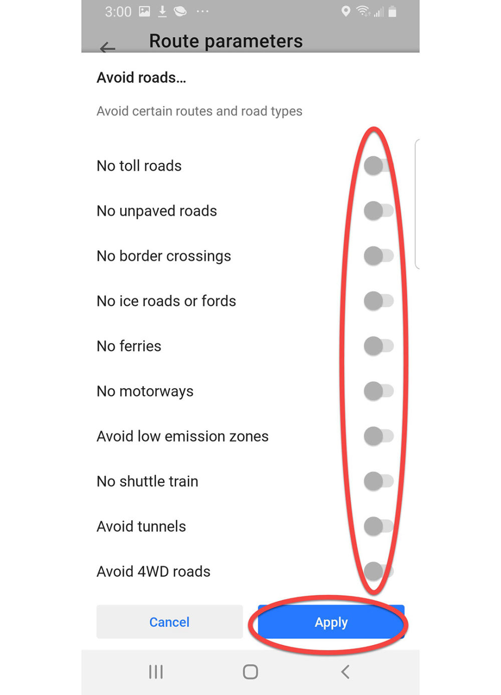
Route parameters Avoid roads
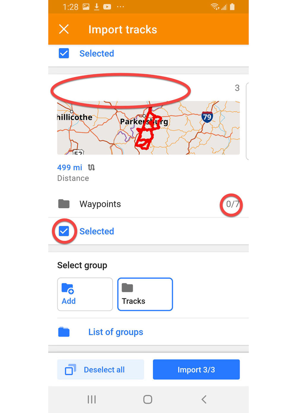
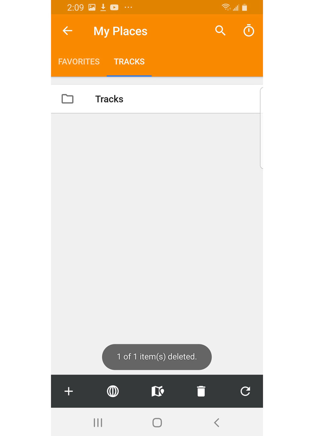
Make sure all avoidances are Disabled and press Apply. Scrroll down
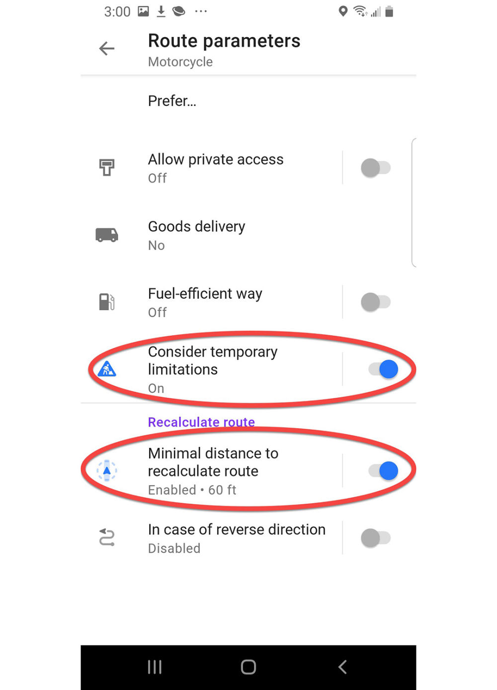
Route parameters Motorcycle
Enable Consider temporary limitations (takes local construction reports into account)
Enable off-route recalculation Minimal distance to recalculate route, select it and set distance to 60 feet and press Apply.
Press Back arrow to return to Navigation settings Motorcycle.
Navigation settings Motorcycle
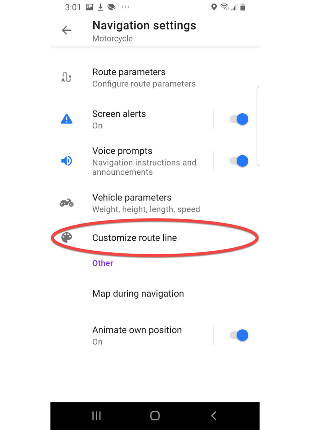
Press Customize route line.
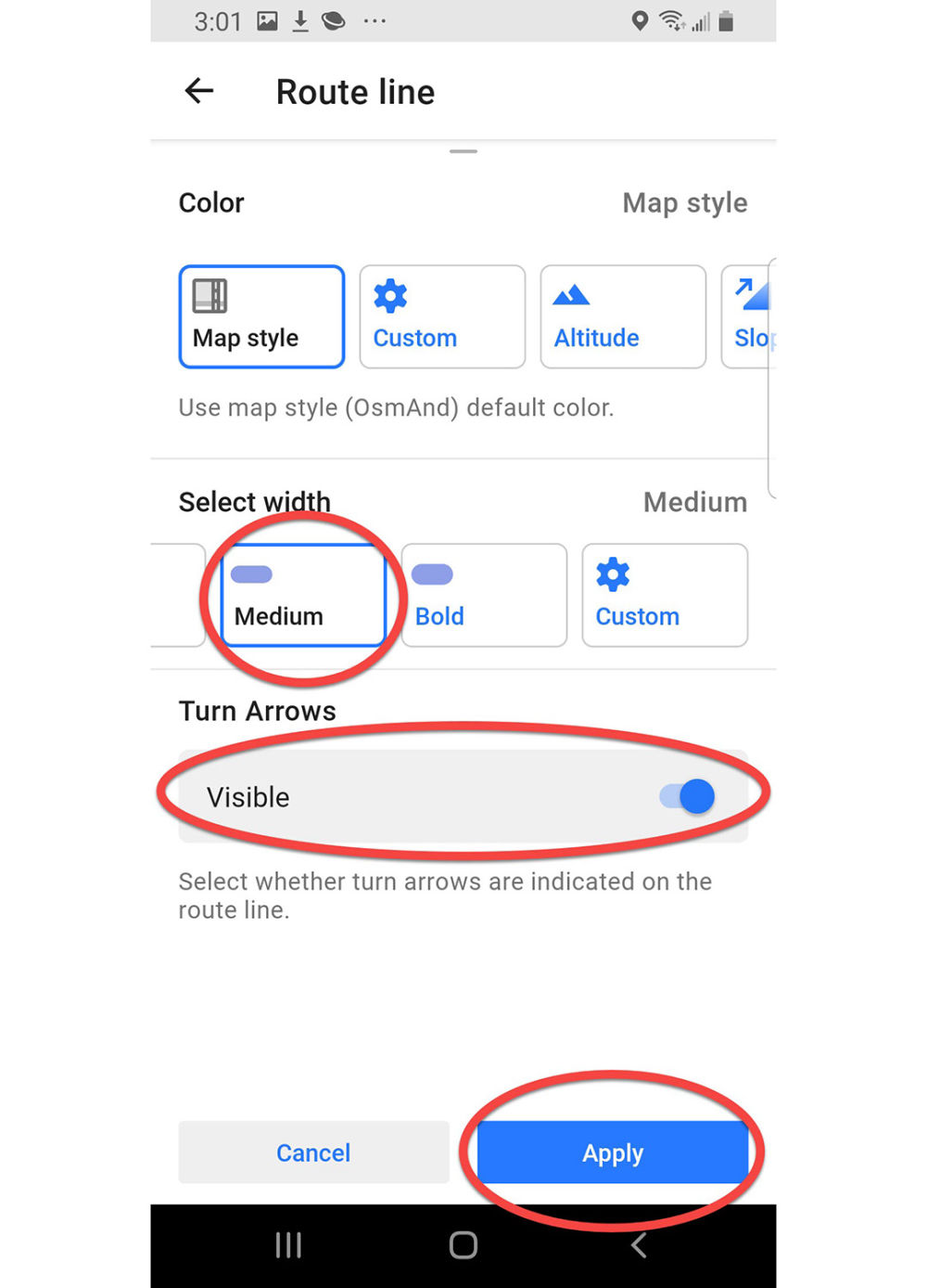
Route Line
Scroll up, press Medium width,
Enable Turn Arrows Visible
Press Apply
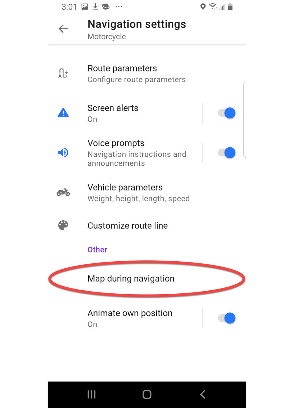
Navigation settings Motorcycle
Press Map during navigation
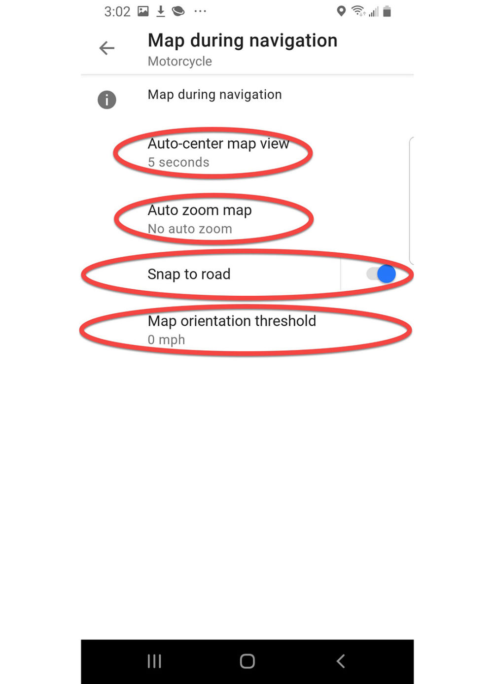
Map during navigation Motorcycle
Press Auto center map view and set to 5 seconds
Press Auto zoom map if you want to change the preference
Enable Snap to road if not already enabled
Press Map orientation threshold and adjust if not already set to 0 mph
Press the Back arrow two times to return to Motorcycle Configure profile
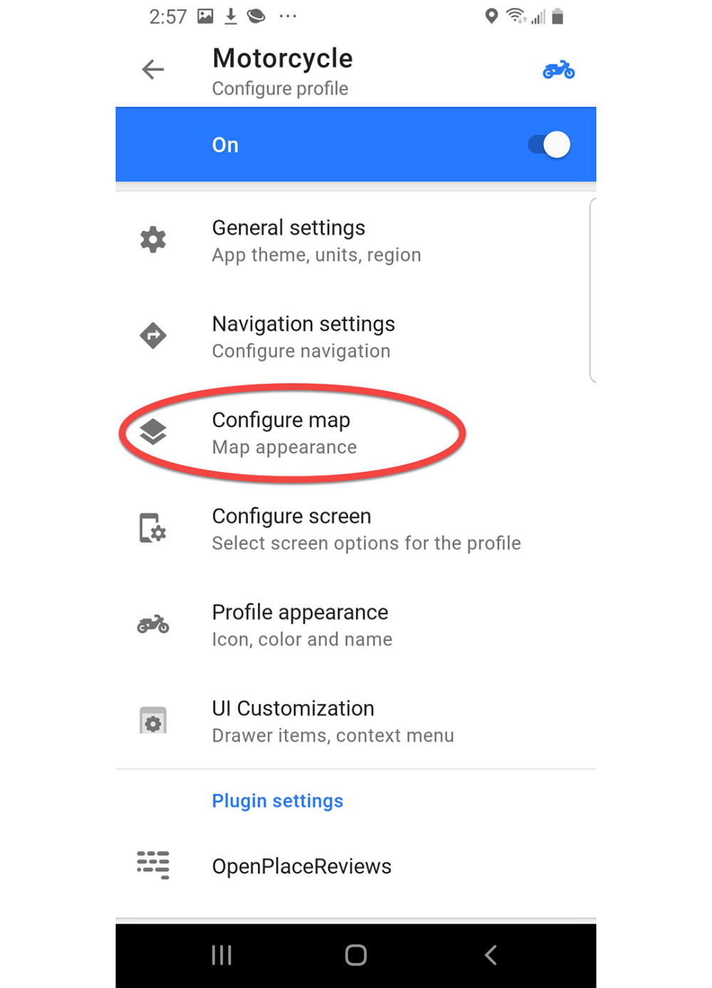
Motorcycle Configure profile
Press Configure map
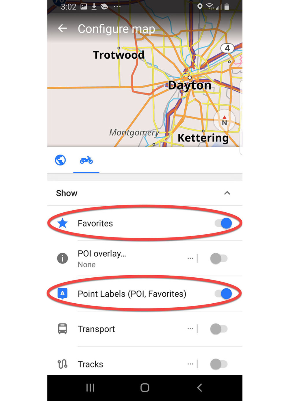
Configure map
Enable Favorites
Enable Point labels
Scroll down
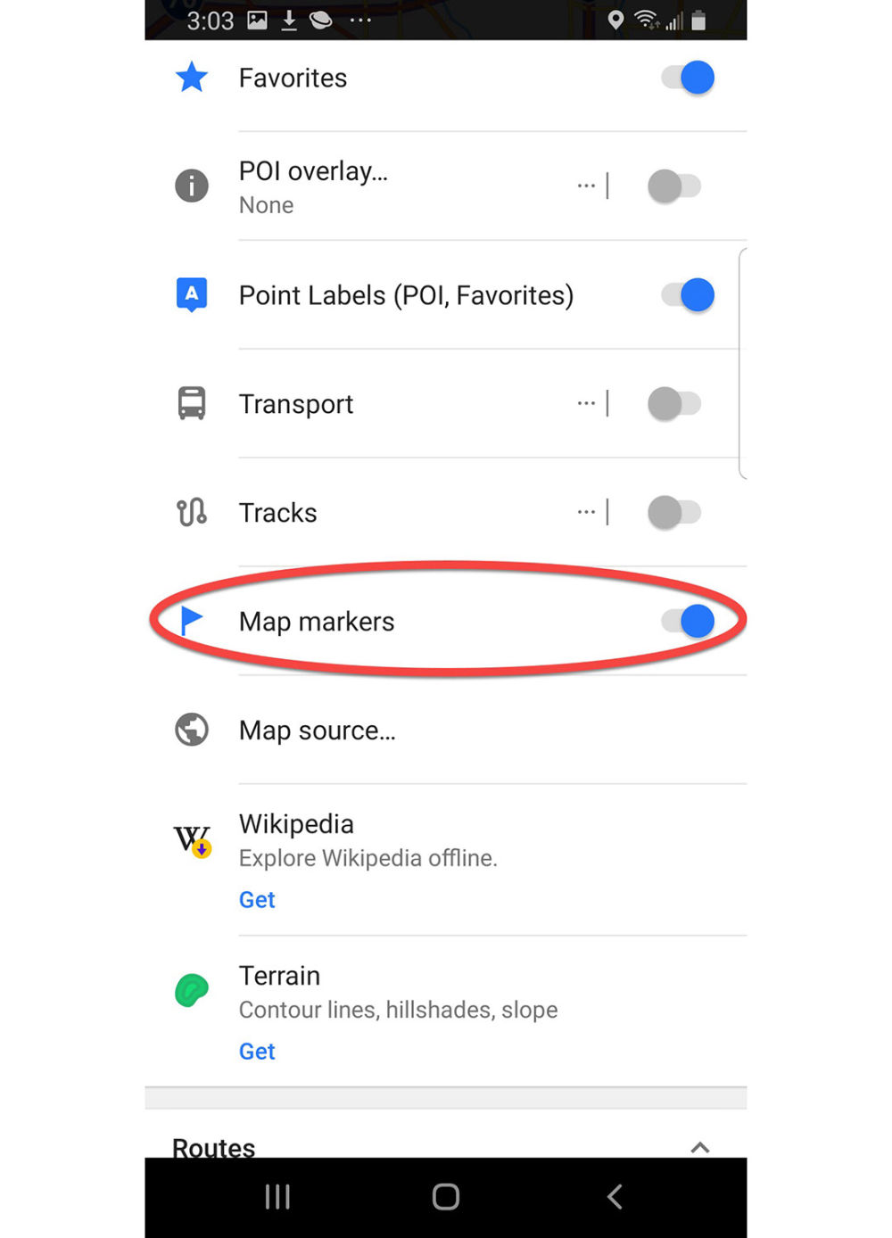
Configure map
Enable Map markers
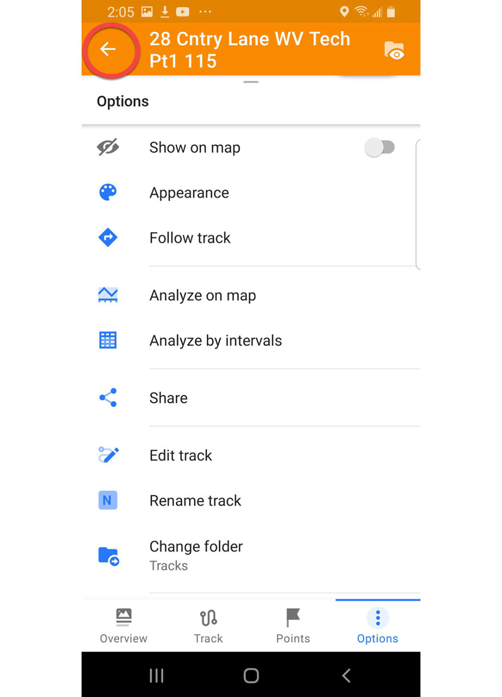
Press Back arrow three times to return to the Map screen
Map screen
Press the Hamburger to open the Configuration menu
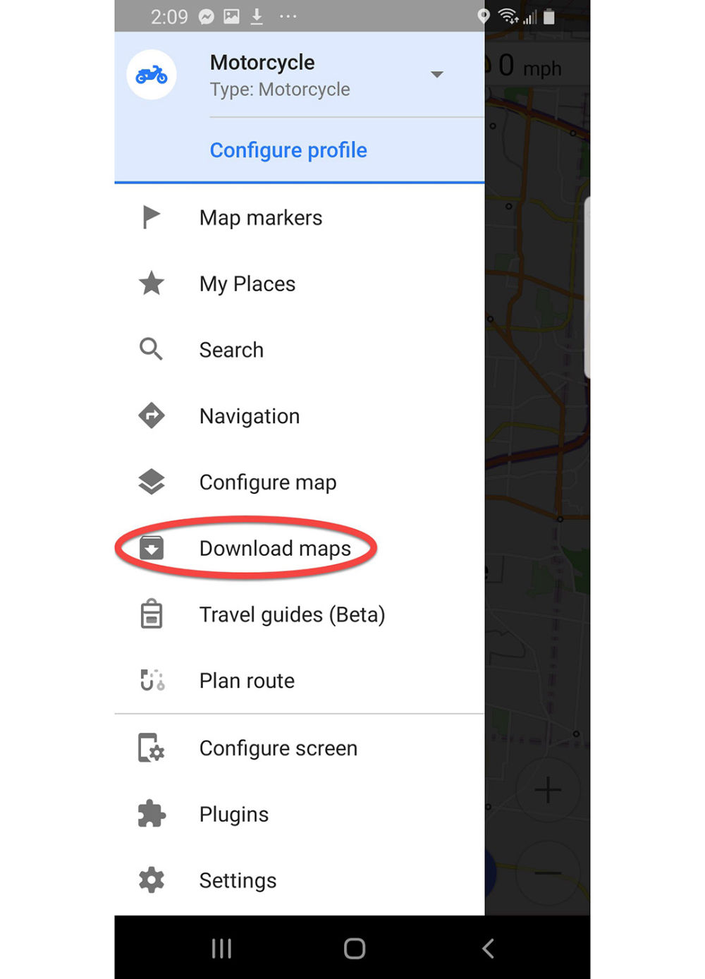
Configuration menu
Press Download maps
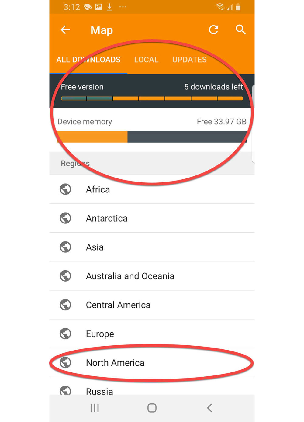
Map download screen
Near the top of the screen you can see that we are running the free version of OsmAnd, which only allows 7 map downloads. I have already downloaded Ohio and Indiana so there are five left. Press North America, look for the states you want. Downloading takes a lot of device memory so make sure your phone has plenty. Expect 5-10 minutes per state on a fairly fast connection, preferably WiFi.
Press the Back arrow to return to the Map screen.
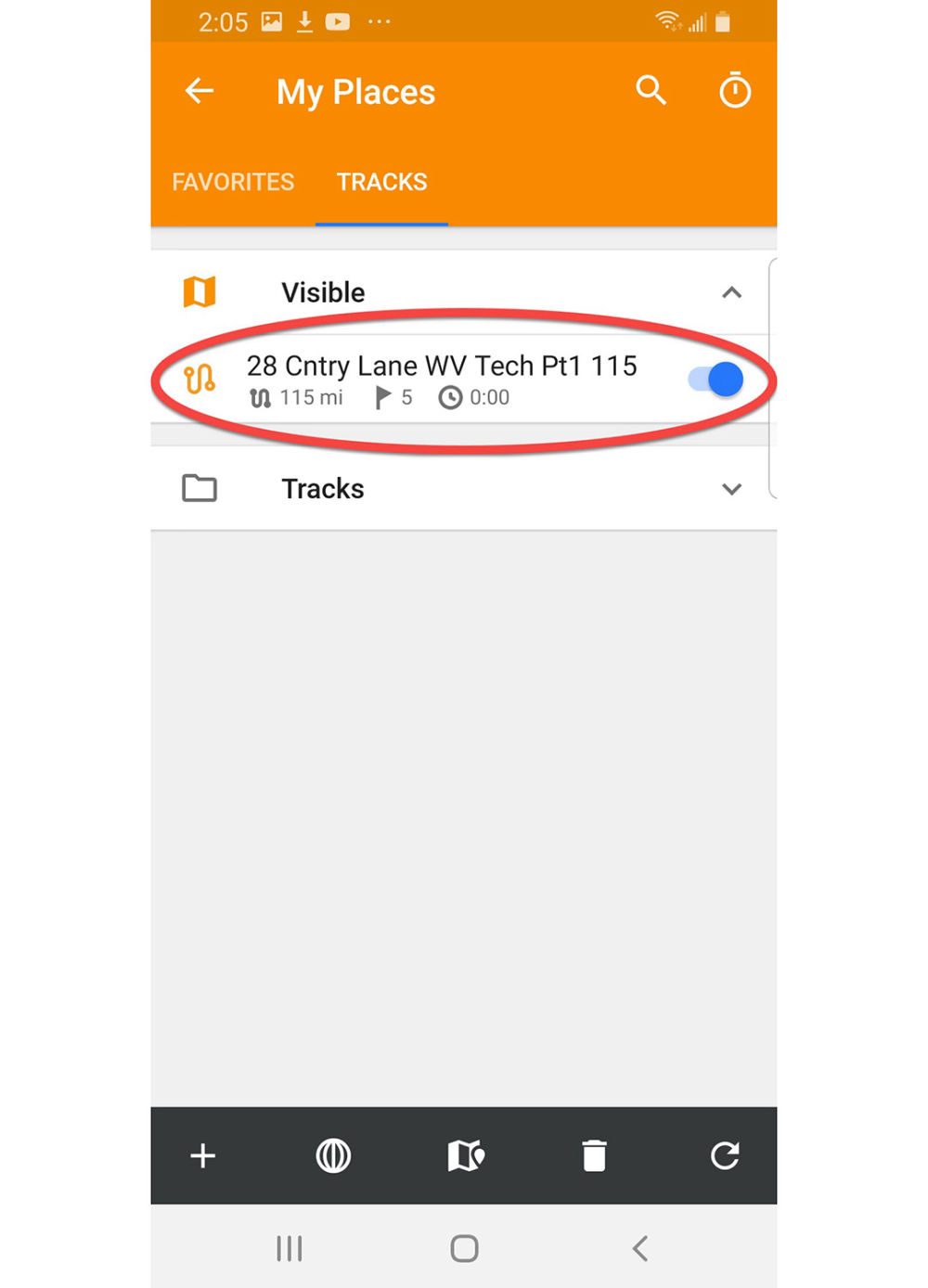
Setup My Places for easy file import
This will be our final configuration task in the initial setup.
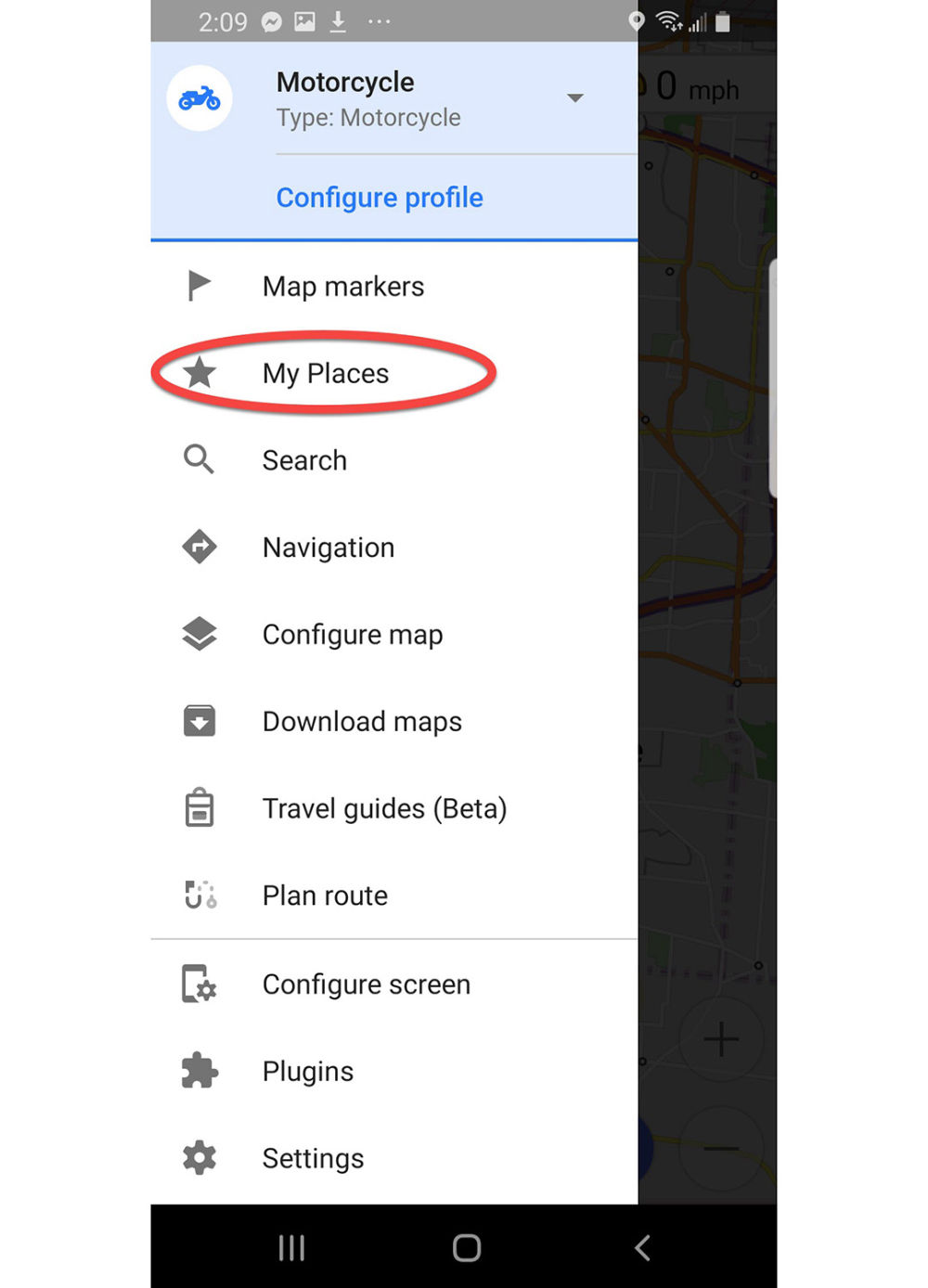
Press the Hamburger to open the Configuration menu
Setup My Places for easy file import
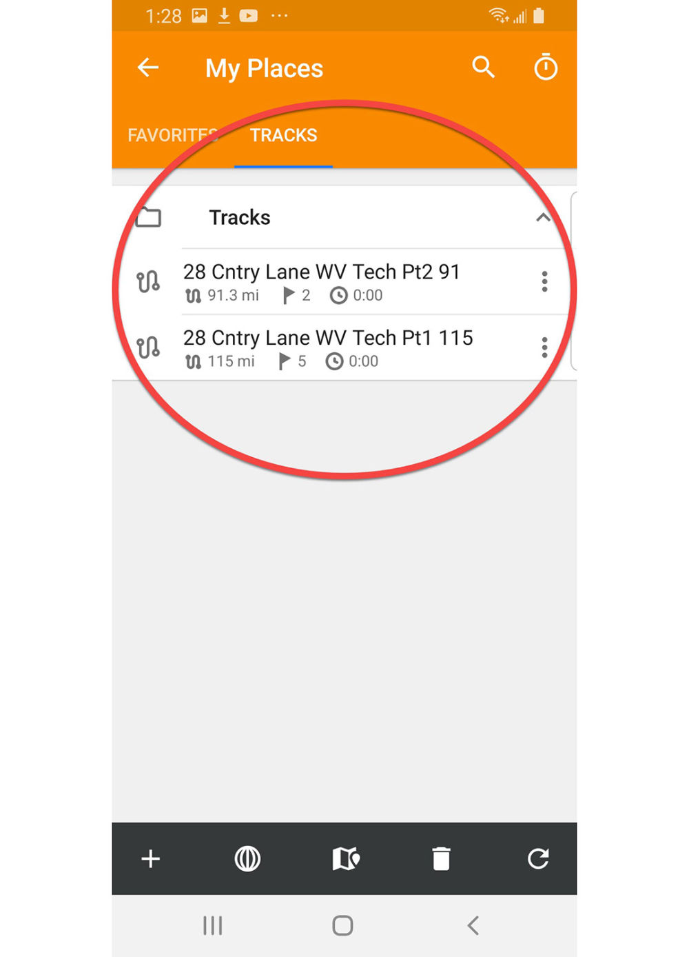
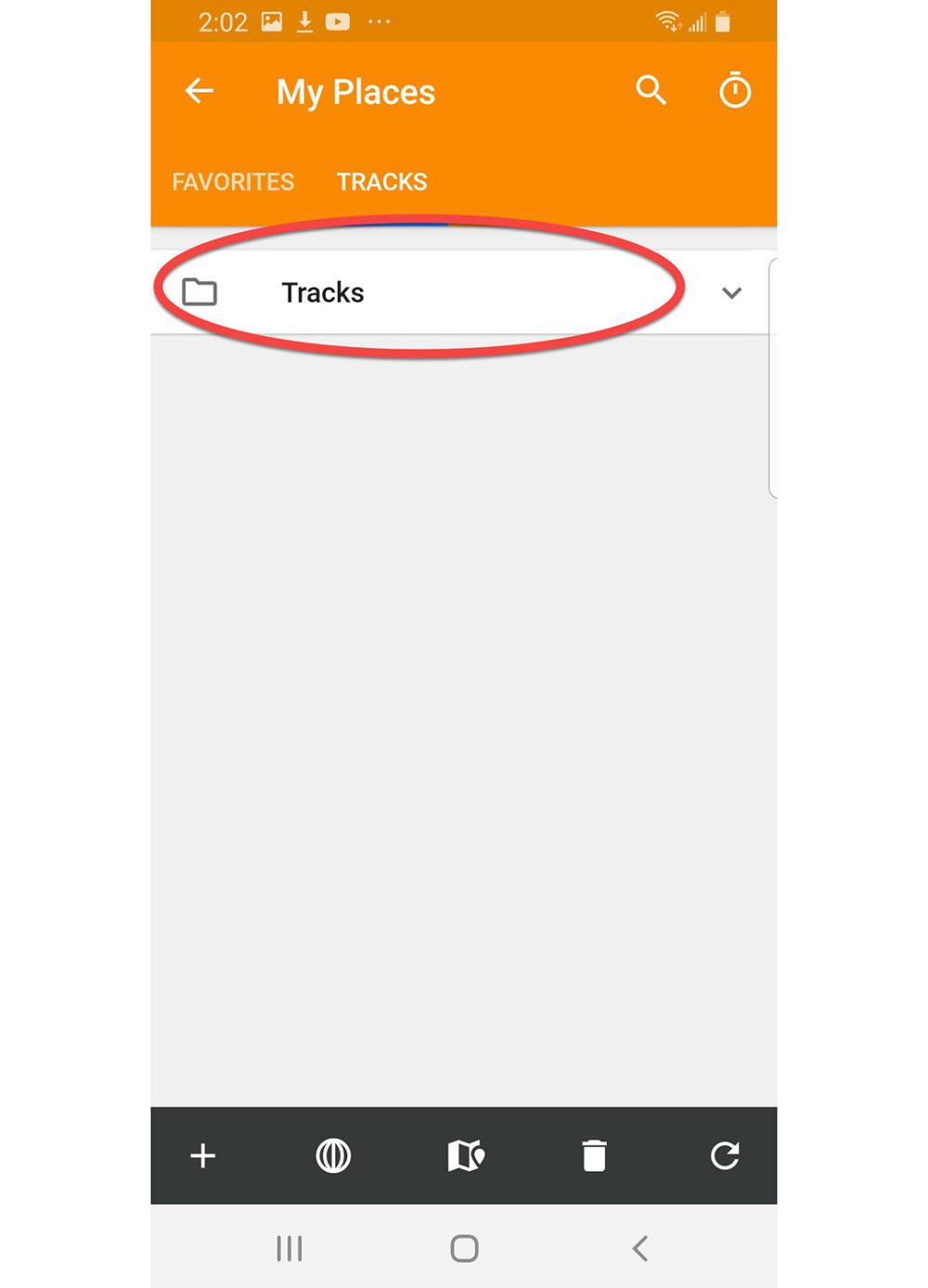
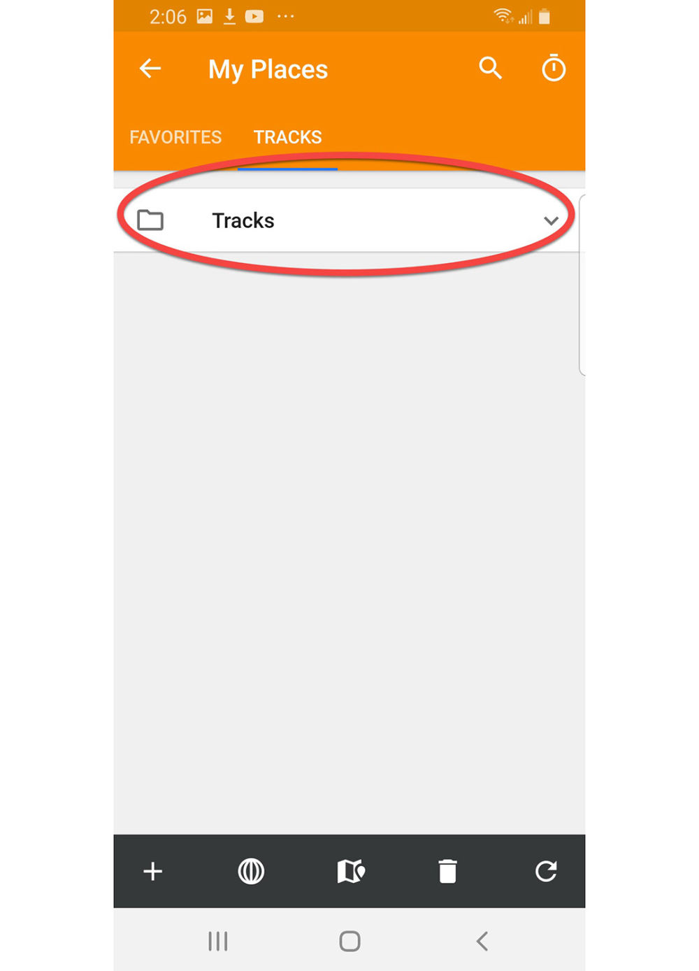
Press My Places
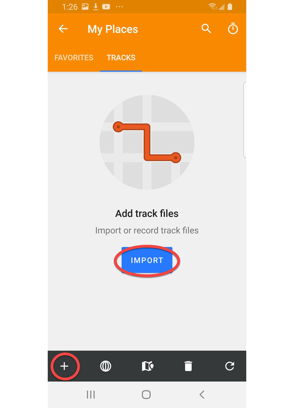
Setup My Places for easy file import
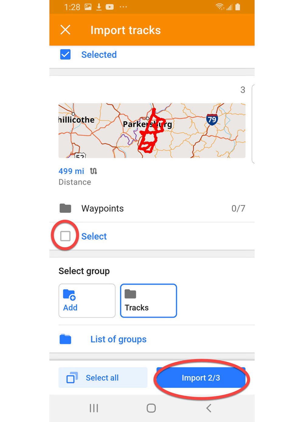
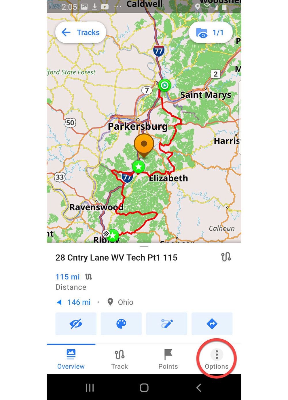
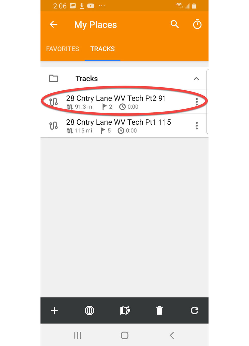
Press the Import button or the + symbol at the bottom left
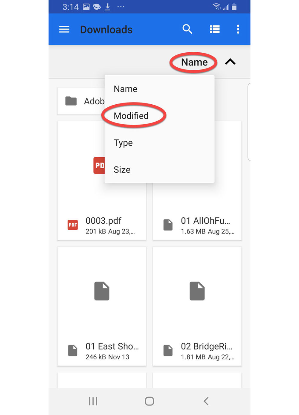
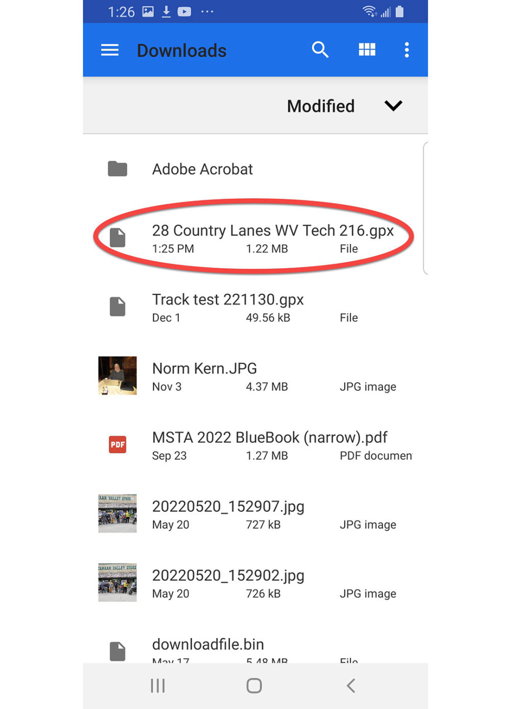
Downloads
Press Name and the dialog box will open
Press Modified. This makes oldest downloads appear first.
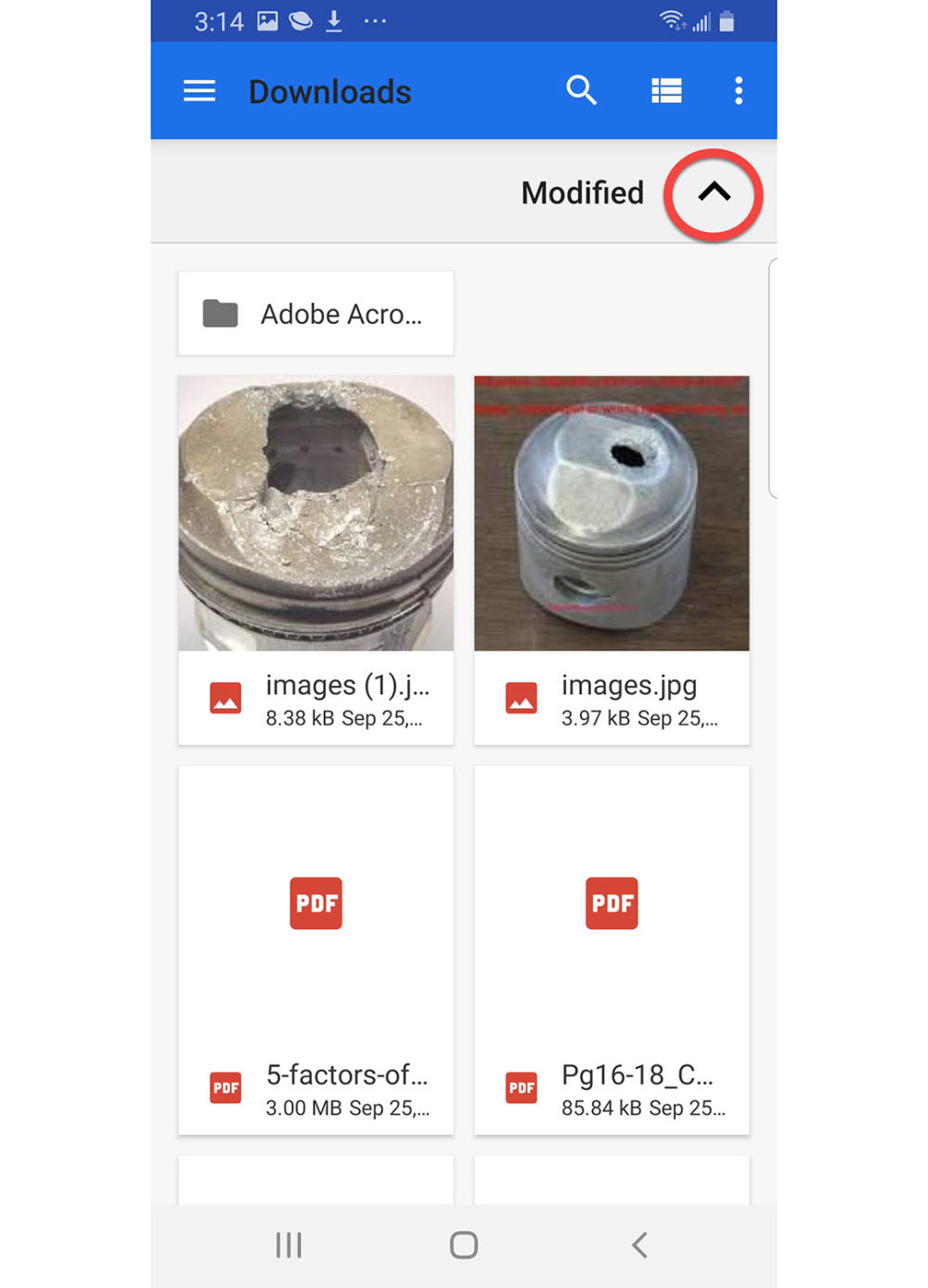
Downloads
Press The Up arrow and it will change to a Down arrow.
Downloads
Now the newest downloaded files will appear first. Since you probably want to import the GPX files you just downloaded this is a good thing!
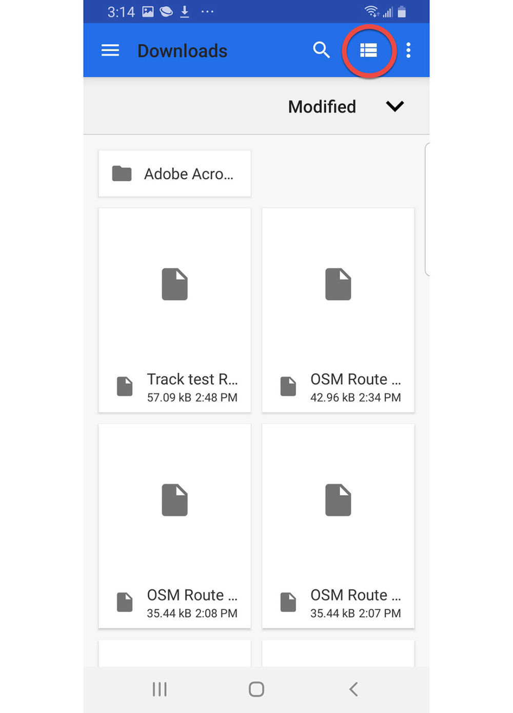
One more trick-
Press the View icon at the top right of the screen
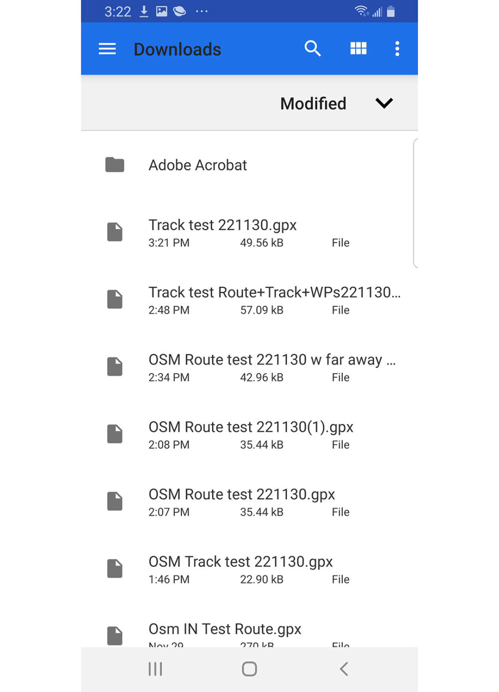
Downloads
Now we can see the actual file names so it's easy to identify the GPX files and their exact names. This will make importing much easier in the future.
Congratulations- OsmAnd is all set for you to use!
Below on this page, there are three shorter tutorials-
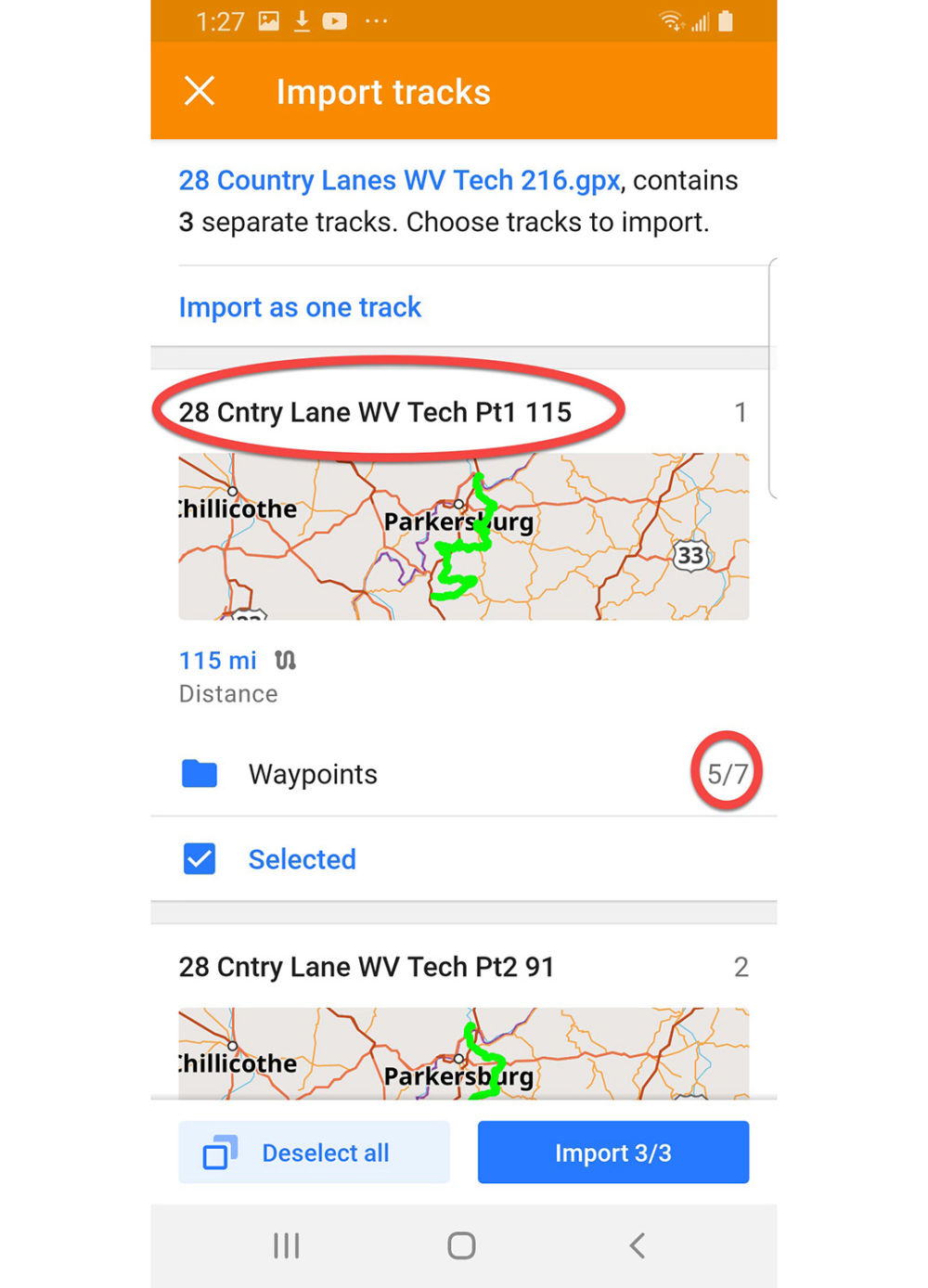
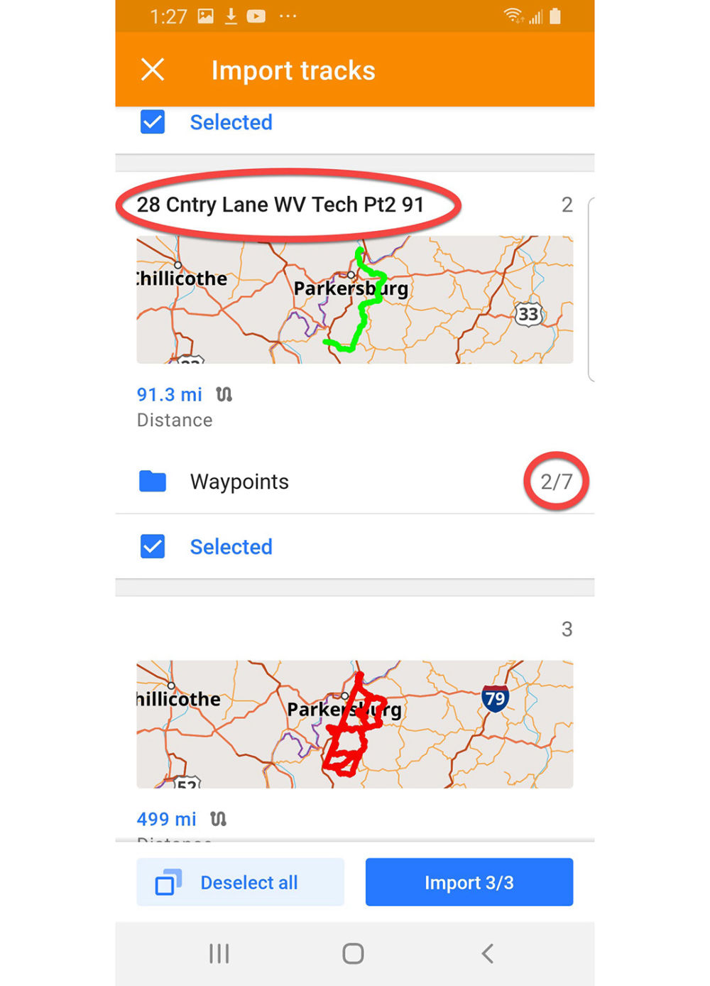
1. GPX Route Import & Setup
2. Navigating a Route
3. Delete Routes & Clean Up